The Bay and Its Seasons
Reading Bottom Before You Enter It
How shore divers read route, depth, structure and fish from the surface, with notes on the Cabo de Gata and its dive sites.
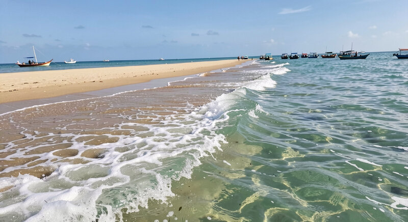
A diver standing on the rocks above a shore entry can learn most of what the bottom will do before the mask goes on. Route, depth, structure and the fish that hold on it are all legible from the surface if the light is right and the swell is honest. The reading takes ten minutes and it decides whether the dive is worth the walk down.
The method is the same on any coast. It is worth setting it out plainly, because the same four questions come up on Cape Cod Bay and on the Andalusian shore, where the bottom is volcanic, the reserve rules are strict, and the entries are often a scramble over rock. A diver planning a trip to the Spanish south will find the site descriptions and the practical notes on Cabo de Gata dive sites useful before committing to a route, and the questions below are the ones that come back most often from readers who have never dived there.
What is seen while diving in the Cabo de Gata-Nijar Natural Park?
The park occupies the southeastern corner of the province of Almeria, between the town of the same name and the village of San Jose, and it is both a terrestrial and a marine protected area. Underwater, the bottom is a mix of volcanic rock, sand channels and seagrass. The Posidonia oceanica meadows are the structural heart of it: they stabilise the sand, they oxygenate the water, and they shelter juvenile fish. Around them the rock carries gorgonians, sponges, anemones and coralline algae, and the fish life follows the structure rather than the open water.
What a diver actually sees depends on depth and on how much the site is visited. In the first ten metres the light is good and the rock is covered with algae and small wrasse. Below twenty metres the colour changes: the reds and oranges of the gorgonians come back with a torch, and the fish are larger and less moved by a diver. Groupers are the species most readers ask about, and they are resident rather than passing. Bream, damselfish, octopus, cuttlefish and, on sandy ground, rays and flatfish are all common. The reserve status means the fish are not hunted and behave accordingly.
The practical consequence for a shore diver is that the park rewards a slow, low route along the rock edge rather than a swim across open sand. The structure is where the fish are, and the structure is almost always within a few metres of the shore.
Is the Isla de San Andres worth diving?
Yes, with a condition. The Isla de San Andres lies off the Cabo de Gata headland and is one of the most cited sites in the park. It offers a rocky profile with a range of depths, so a diver can stay shallow on the top of the reef or drop down a wall, and the fish life is dense because the island sits inside the protected area. It is a boat site for most visitors, and it is exposed: when the swell runs from the east or the wind is up, the crossing is uncomfortable and the dive is not worth the trip.
The condition is the weather, not the site. On a calm day with good visibility the island gives a diver the full range of what the park holds in a single descent: rock, seagrass edge, sand, and the fish that work between them. On a bad day it gives a rough ride and a dark, moving bottom. The same rule applies here as anywhere on this coast: read the forecast and the swell direction before booking, and treat the decision as a sea decision rather than a schedule decision.
What is La Catedral and what level does it require?
La Catedral is a rock formation in the Cabo de Gata area whose profile is said to resemble a cathedral, and it is one of the deeper and more demanding dives in the park. The structure rises from deeper ground, so the diver is working on a vertical face rather than a gentle slope, and the depth at the base puts it beyond the range of a beginner on a single tank.
The level required is the usual one for this kind of profile: an advanced certification, or a deep specialty, plus recent experience of descents past twenty metres and of buoyancy control on a wall. A diver who has only ever worked shallow seagrass and sand will find the change of scale uncomfortable on the first attempt. The site is also exposed to the same weather as the rest of the headland, so it is a fair-weather dive. It is not a site to attempt as a first dive in the park, and it is not a site to attempt without a guide who knows the mooring and the current.
Reading route, depth and structure from the surface
A shore diver reads the entry first. The route down is the part of the dive that cannot be abandoned halfway, so it is read before anything else: where the rock is dry, where it is wet and slippery, where the swell reaches, and where a diver can stand to put fins on. On volcanic coasts the rock is often sharp, and the entry is a step rather than a beach.
Depth is read from the colour of the water and from the chart. Shallow sand shows pale; rock and seagrass show dark; a change of tone a hundred metres out is usually a change of bottom. A diver who knows the tide and the chart can predict the depth at the foot of the entry and plan the profile before entering.
Structure is read from the surface as a line: the edge between sand and rock, the top of a reef, the mouth of a channel. Fish hold on structure, and the structure is visible as a change in the water's texture and colour even when the bottom itself is not. On a calm day with the sun behind the diver, the edge of a Posidonia meadow is legible from standing height.
The fish that hold on the structure
The rule is old and it holds in both hemispheres: find the edge, find the fish. On the Cabo de Gata rock the edge is where the gorgonians and the sponges are, and the groupers sit on it. On sand the fish are scattered and small; on the boundary between sand and seagrass they are concentrated. A diver who swims the line rather than across it will see more in twenty minutes than a diver who covers twice the distance in open water.
Current matters as much as structure. Where the water moves, the fish face into it and feed; where it is slack, they shelter. A shore diver can read the current from the surface by watching weed, foam lines and the drift of a floating leaf, and can plan the route so that the swim out is against it and the return is with it.
What this means for the entry
The reading is done standing up, and it takes ten minutes. Route, depth, structure and fish are four questions, and the answers are visible from the rocks on most days. The dive that follows is not a guess; it is the execution of a plan made in the open air, with the mask still dry. On Cape Cod Bay the bottom is sand and glacial rock and the visibility is often poor, so the reading leans on the chart and the tide. On the Andalusian coast the bottom is volcanic and the visibility is better, so the reading leans on the eye. The method does not change.